


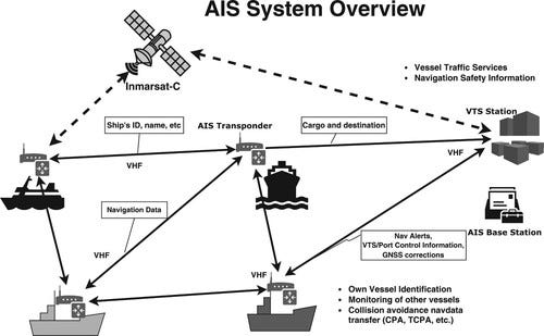
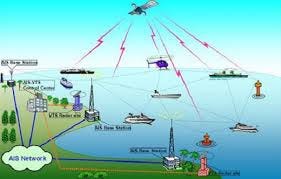
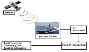
Maritime OSINT involves collecting intelligence about vessels, ports, maritime infrastructure, and crew members using publicly available sources. Modern ships continuously transmit operational and positional data through systems such as AIS, satellite communications, and maritime radio networks, creating multiple data points that investigators can leverage
These data sources enable analysts to identify vessel movements, ownership structures, crew members, cargo patterns, and potential security vulnerabilities across the global maritime ecosystem
Vessel Tracking and Identification
— — — — — — — — — — — — — — — — — — — — — — — — -
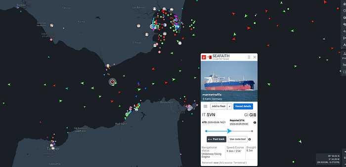
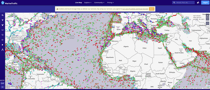
MarineTraffic is one of the most widely used AIS-based vessel tracking platforms
It enables investigators to:
- Track real-time vessel locations
- Identify ship type, flag state, call sign, and tonnage
- Review historical voyage routes
- Analyze port arrival and departure timelines
The Voyage Timeline feature provides historical route data that can be used to confirm vessel identity and reconstruct shipping patterns
AIS data also allows analysts to detect:
- Suspicious route deviations
- AIS signal gaps (possible deliberate disabling)
- Unexpected port stops
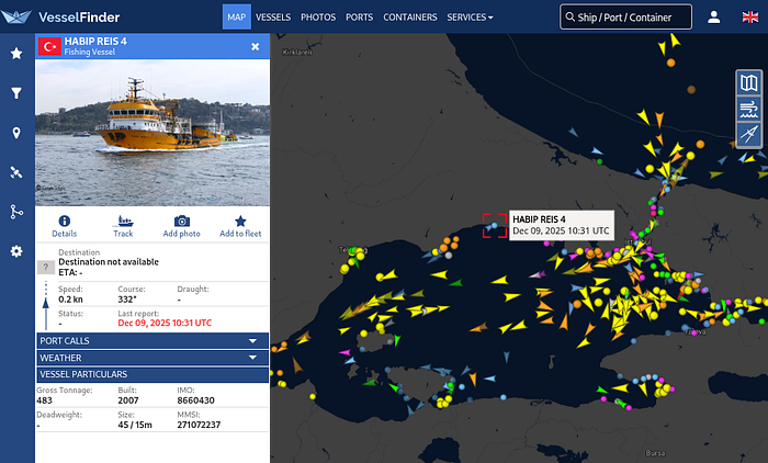
VesselFinder
VesselFinder provides similar AIS-based vessel intelligence and serves as a secondary verification source
Using multiple tracking platforms allows analysts to:
- Validate vessel data
- Cross-reference voyage history
- Identify discrepancies in AIS reporting
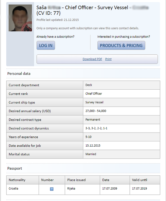
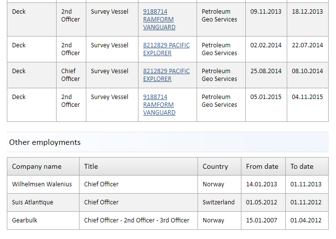
Crew and Personnel Intelligence
— — — — — — — — — — — — — — — — — — — — — — — -
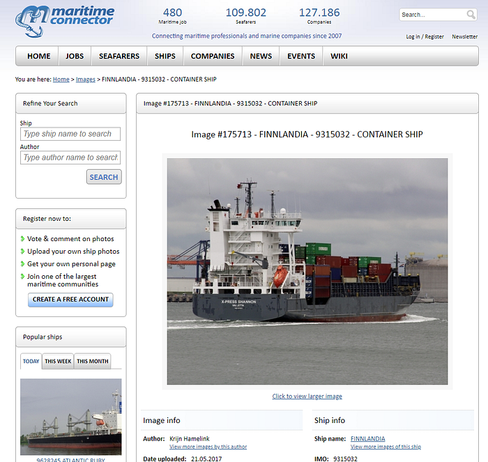
Maritime Connector
Maritime Connector is a maritime employment and networking platform that provides valuable intelligence about crew members and vessel personnel
Available information may include:
- Crew roles (Chief Officer, Captain, Engineer)
- Employment history
- Certifications and maritime licenses
- Nationality and experience
This information can be correlated with professional networks such as LinkedIn to identify personnel connected to specific ships or shipping companies
Crew intelligence is particularly valuable for:
- Social engineering assessments
- Insider threat analysis
- Attribution in maritime incidents
Maritime Infrastructure Reconnaissance
— — — — — — — — — — — — — — — — — — — — — — — — — — — — —
Shodan
Shodan enables investigators to discover internet-exposed maritime infrastructure, including:
- Satellite communication terminals
- Vessel management systems
- Remote administration services
- Navigation infrastructure
Security analysis with Shodan may identify:
- Exposed RDP services (port 3389)
- Weak or outdated SSL/TLS configurations
- Open Telnet or SSH ports
- Public satellite terminal management interfaces
- Vulnerable ship communication systems
These exposures may allow attackers to map maritime infrastructure, intercept communications, or gain unauthorized access to vessel networks
Vessel Identification Systems and Detecting Illegal Maritime Activity
— — — — — — — — — — — — — — — — — — — — — — — — — — — — — — — — — — — — —

UICVs : Unique identifiers assigned to maritime vessels that allow analysts and investigators to reliably track ships across multiple maritime databases, registries, and tracking systems throughout their operational lifetime
IMO Number: A permanent global identification number assigned to a vessel for its entire operational life
MMSI: The Maritime Mobile Service Identity used for AIS communication and digital maritime transmissions
IRCS: The International Radio Call Sign assigned to a vessel for radio communication at sea
National Registration Number: A registry number issued by the vessel's flag state as part of its national maritime registry
RFMO ID: An identifier used by Regional Fisheries Management Organizations to monitor and regulate fishing vessels
These identifiers allow investigators to track vessels even when ship names, ownership, or flag registrations change, making them essential for maritime OSINT investigations
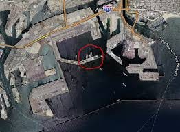
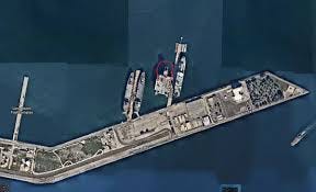
Port Intelligence and Analysis
— — — — — — — — — — — — — — — — — — — — —-
Ports represent critical nodes within global supply chains and are often exploited for smuggling and illicit logistics operations.
OSINT analysts investigating ports should examine:
- Vessel traffic patterns
- Port infrastructure
- Cargo logistics
- Historical satellite imagery
- Personnel and contractors
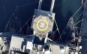
Satellite platforms such as Google Earth enable analysts to observe:
- Port expansion and construction
- Vessel dock positions
- Cargo storage activity
- Infrastructure changes over time
Maritime Communication Monitoring
— — — — — — — — — — — — — — — — — — — — — — — — — — — -
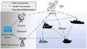
Several maritime communication systems transmit operational and safety-related signals that can provide valuable intelligence during maritime investigations.
VHF Marine Radio: Used for ship-to-ship communication, port coordination, and emergency distress calls at sea
NAVTEX: A broadcast system that delivers navigational warnings, weather alerts, and maritime safety information to vessels
Inmarsat EGC: A satellite-based service providing global maritime safety messages and emergency broadcasts
LRIT: The Long-Range Identification and Tracking system used by authorities to monitor vessel positions over long distances
Monitoring these communication systems can help analysts identify vessel emergencies, navigational warnings, operational alerts, and maritime incidents, providing additional context for maritime OSINT investigations
Real Maritime Investigation Practice (Self-Lab)
— — — — — — — — — — — — — — — — — — — — — — — — — — — — — — — — — —
If you are looking to develop practical Maritime OSINT investigation skills, try completing the following self-designed intelligence challenge
Select a random cargo vessel using MarineTraffic or VesselFinder and conduct a full maritime intelligence investigation
Objectives :
1. Vessel Identification
Determine the IMO number
Identify the flag state
Discover the owner and operating company
Collect vessel specifications and historical records
2. Voyage & Activity Analysis
Reconstruct the vessel's recent voyage timeline
Identify previous ports of call
Detect route anomalies or AIS gaps
Analyze patterns of port visits and cargo routes
3. Intelligence Pivoting
Crew profiling via LinkedIn
Company ownership and subsidiaries through official websites
Vessel verification through satellite imagery analysis
Final Task
Produce a structured OSINT report detailing vessel identity, operational activity, ownership network, and any suspicious maritime patterns or security indicators.
If you are interested in practicing advanced Maritime open source intellegence labs, you can explore challenges on Hacktoria : https://hacktoria.com/intro-to-maritime-osint/
Disclaimer: All information in this write-up is provided strictly for educational and research purposes. The techniques and tools mentioned are intended for learning Open Source Intellegence and security analysis , and must be used ethically and legally